Levity Creations
GeoSpatial, GIS and Ecological Data Aqusition, simulation and consultancy

Geospatial Data Capture, processing
and Predictive Geospatial Analytics


Aerial Service Provider
We capture cm level GIS data using aerial and terrestrial Photogrammetry, LiDAR and Photography.
We process this data for a variety of deliverables.
These outputs range from
Colored Point CloudsOrtho-mosaicsDigital Elevation Models (DEM)Contour MapsDigital Twins
DJI Matrice 300 RTK

Flying a Matric 300 RTK system for best in class industrial performance operations and GIS applications.
DJI P1 Full Frame Camera

We are using the DJI P1 Full Frame Camera for orthomosaics, photogrammerty, photography and video. This provides us with the best in class visual and RGB results.
Ground Station and Ground Control Points

GPS Ground Station for GIS accuracy

Ground Control Points for increase accuracy across multiple data sets.
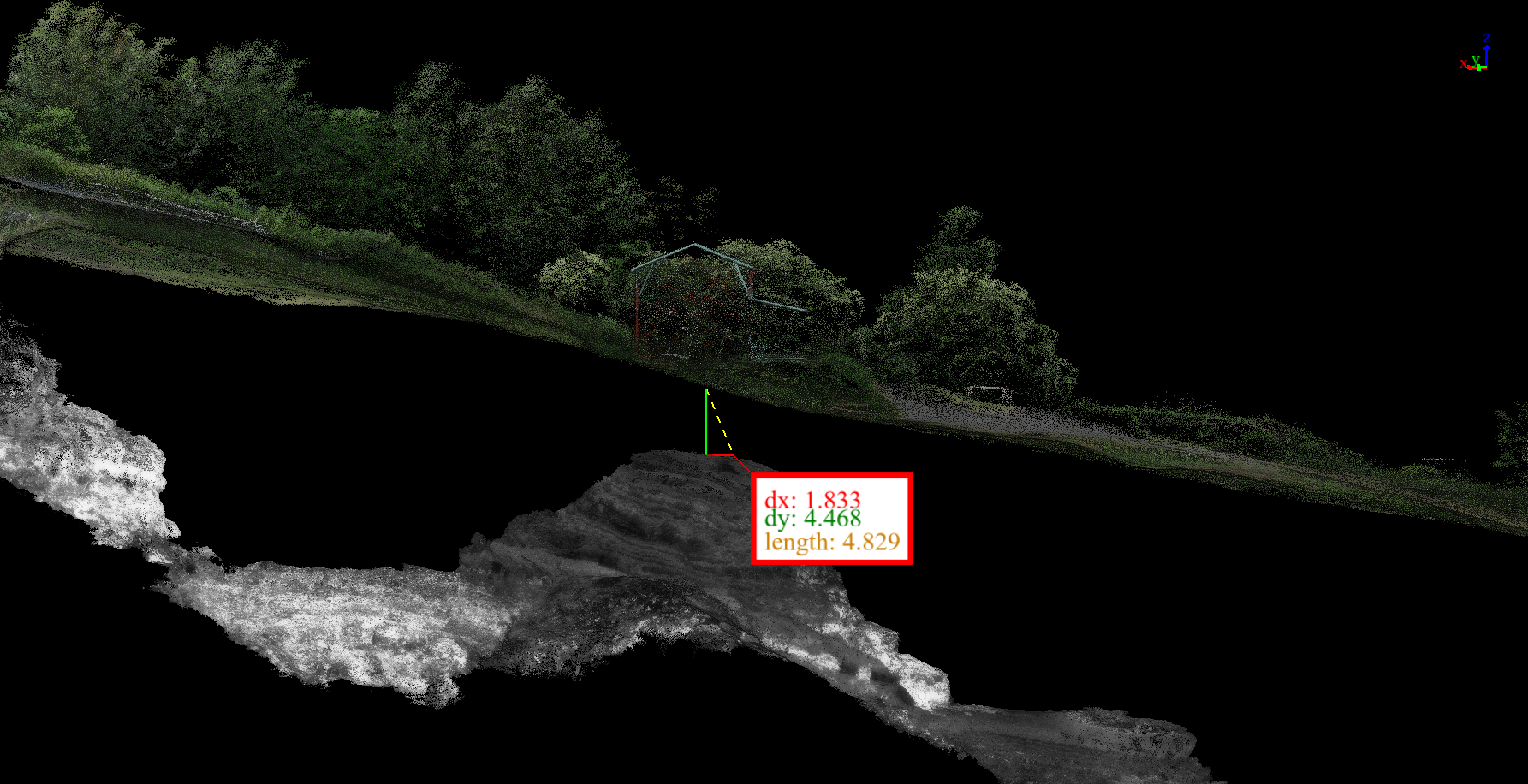
LiDAR

Flying an Inertial Labs RESEPI based Hesai XT32 LiDAR platform
This system has excellent vegetation penetration and accuracy. This unit has a 22% better vegetation penetration than other competing LiDAR systems and is one of the best on the market. This LiDAR places us in the position to provide the most accurate possible deliverables to our clients including: Digital Elevation Models, Topographic Maps, Terrain Reconstruction and Planimetrics on sites that are vegetated.
From LiDAR and Photogrammetry to Digital Twin
Digital Twin creation assisted by LiDAR data

LiDAR data assisting Digital Twin creation - See video below for example