
Visit our new Levity Creations corporate website @ www.levitycreations.com
Levity Creations
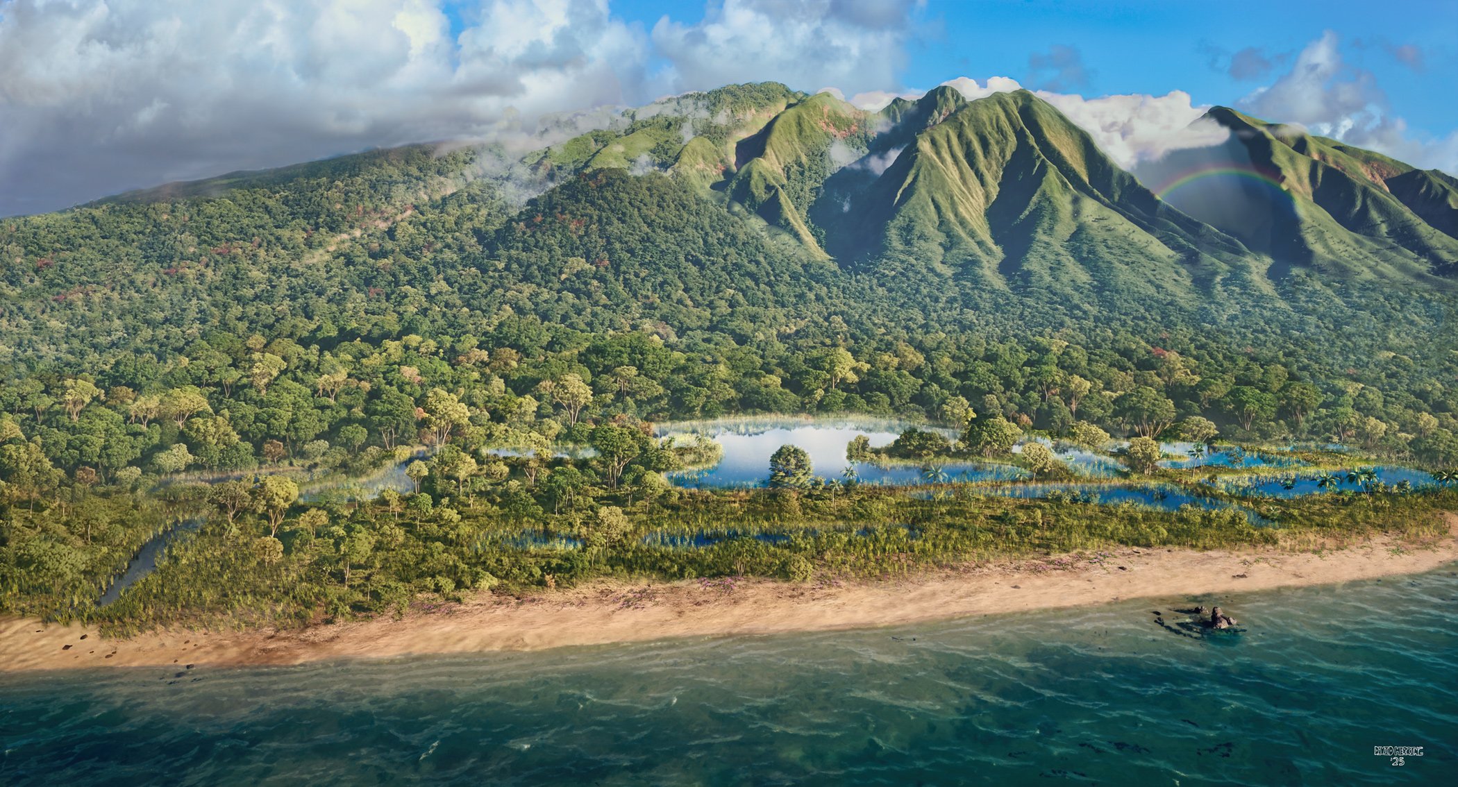
Mapping the Future with Geospatial Precision
Precision LiDAR and Geospatial Intelligence for Maui Land Development, Agriculture, and Engineering.
Levitas by Levity
Insights with Ease
Geospatial Operations


Including
Survey grade LiDAR
High resolution aerial imagery
Photogrammetry
Gaussian splats
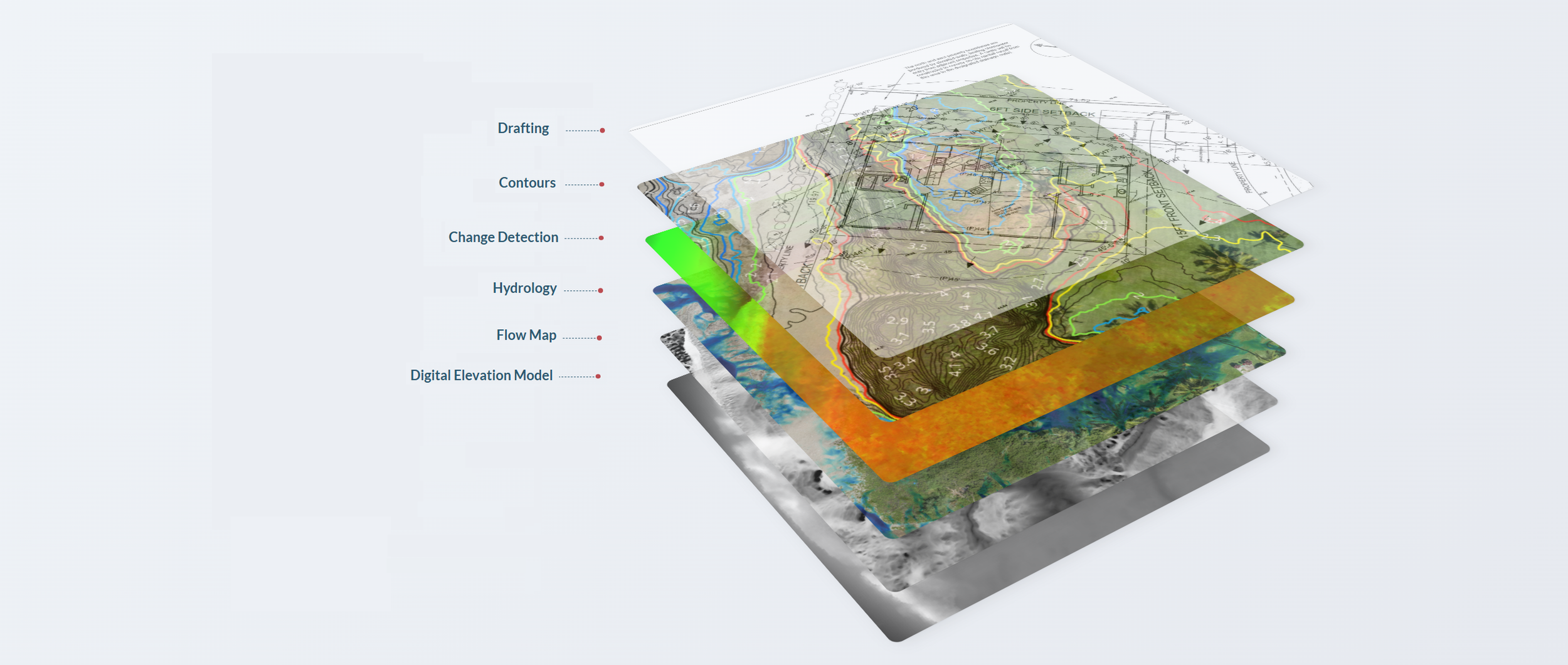
Integrated Planning
Layered Decision- Making
1. Data Collection
2. Data Processing
3. Visualization
4. Data Interpretation
Survey grade LiDAR, high resolution aerial imagery, photogrammetry and gaussian splats
“We specialize in transforming the physical world into actionable intelligence through cutting-edge geospatial technologies. ”
By harnessing survey grade LiDAR, Photogrammetry, and advanced visualization tools, we create detailed maps, immersive simulations, and predictive models tailored to your specific needs.
Whether you're looking to:
Make informed predictions
Streamline stakeholder
communications
Visualize future outcomes
Our solutions deliver clarity and confidence in every project. Let us help you turn complex data into strategic decisions.
Located in Maui, Hawaii
Our Services
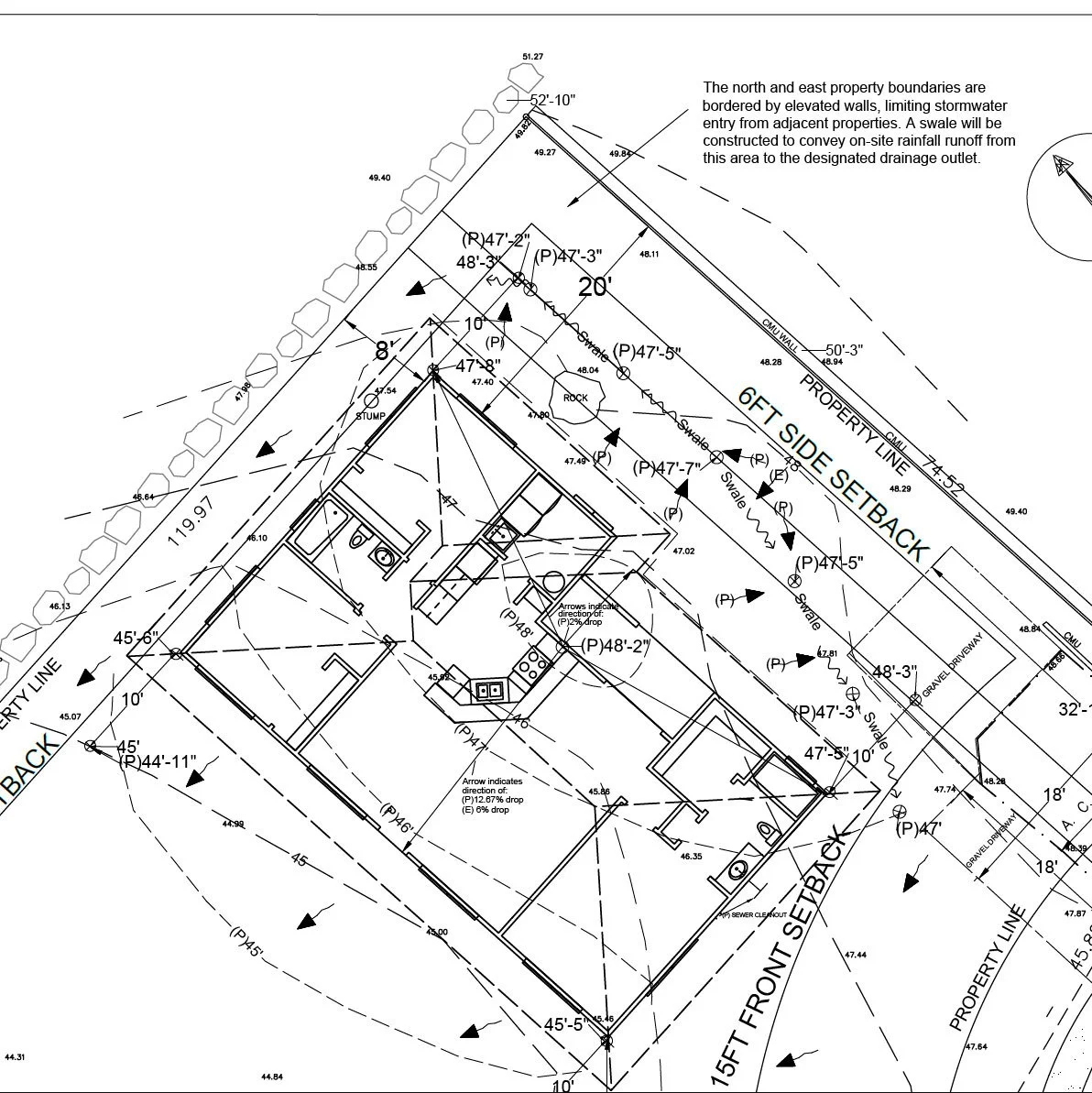
Basic Aerial Data Solutions
Color LiDAR point cloud
Digital Elevation Model (DEM)
Contours
Ortho Map
Advanced Aerial Data Solutions
Color LiDAR point cloud
Digital Elevation Model (DEM)
Contours
Ortho Map
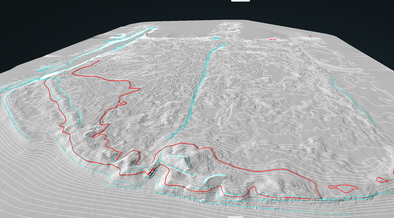
Hydrologic analysis
Volumetric data for vegetation, including tree height and crown volume
Maps can be requested per contract needs including:
Map Layering: Merge multiple maps for layered analysis
Examples
Ortho + Contours
Hillshade + Contours
Flow map + Contours
Predictive Model Solutions
Building predictive models
Tailored prediction models derived from tailored data.
Real-time data visualizations simulating various scenarios.
Digital twins improve decision-making, maintenance, and efficiency. This link between physical and digital assets boosts visibility and supports data-driven strategies for sustainability and excellence.
Providing Services to:
-
-
-
-
Agroforestry, Permaculture
-
Multi-Use land development
-
-
Ecological Research, Hydrologic Studies, Land changes over time
-
-
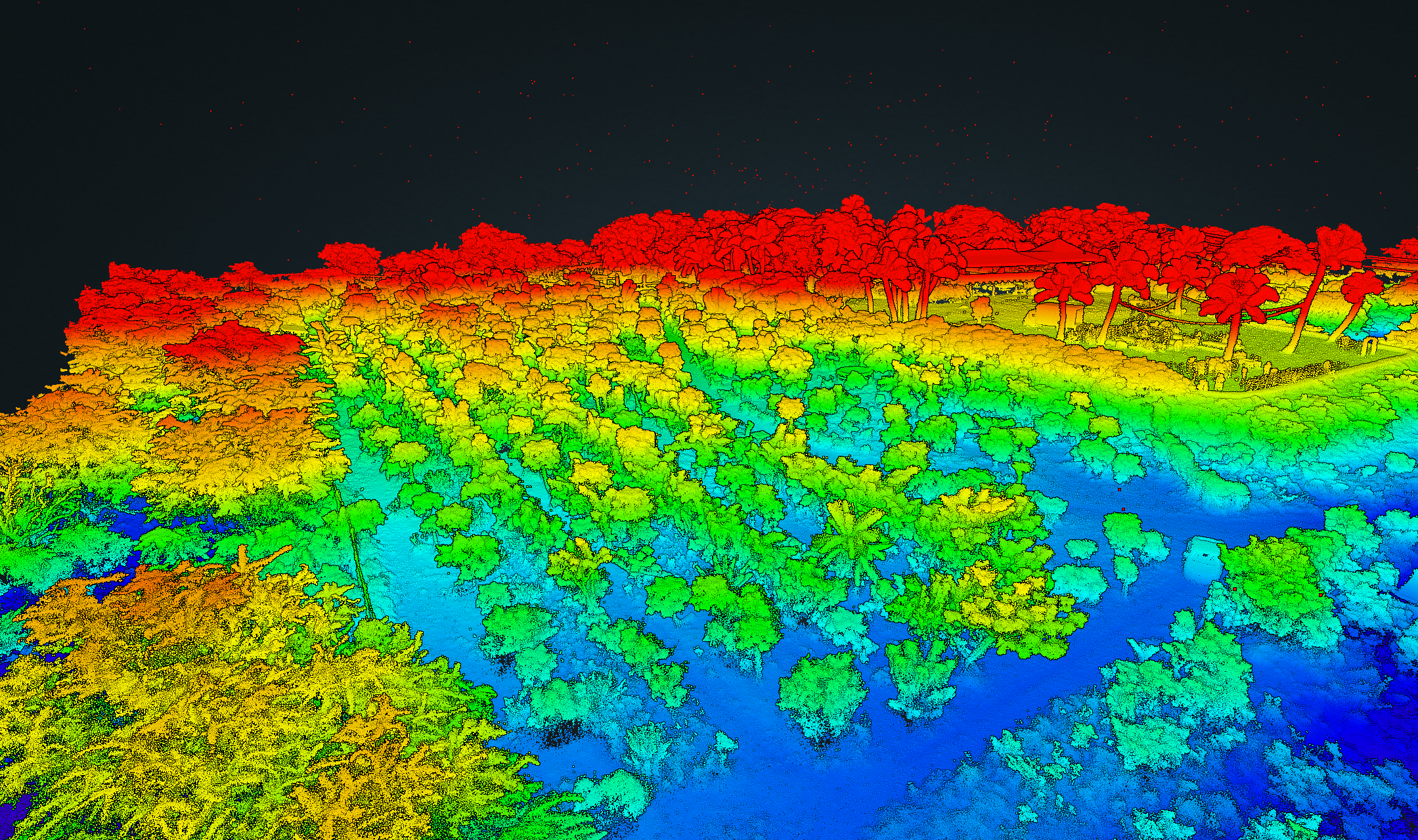
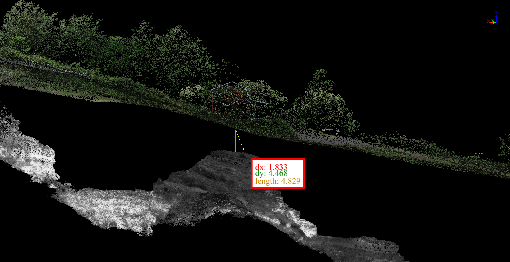
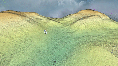
From LiDAR and Photogrammetry to Digital Twin
Raw LiDAR data from Hessie Trail in Colorado

LiDAR data assisting Digital Twin creation - See video below for example
Digital Twin creation assisted by LiDAR data

Reach out to us
We are happy to hear your story and explore how our solutions can be part of your solution
Make informed predictions
Streamline stakeholder
communications
Visualize future outcomes